
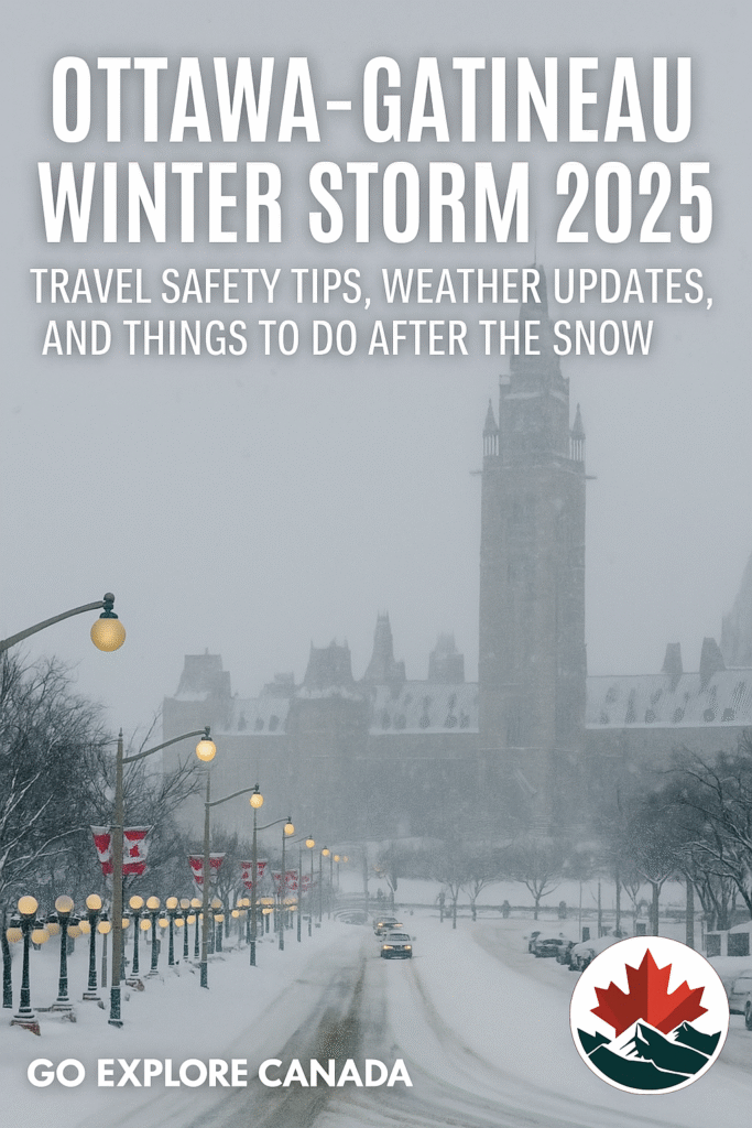
Understanding Freezing Rain in Canada: A Comprehensive Guide
Posted in Weather Phenomena
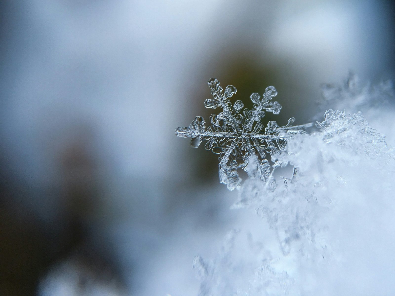
What is Freezing Rain?
Freezing rain is a weather phenomenon that occurs when liquid precipitation falls through a layer of cold air, becoming supercooled before impacting surfaces. This distinct type of precipitation can create hazardous conditions as it forms a layer of ice on contact, resulting in serious implications for transportation and power lines. Understanding the meteorological conditions that lead to the formation of freezing rain is essential for both public safety and preparation.
The process begins with the formation of clouds that generate raindrops. Typically, these raindrops fall through warm air at higher altitudes. However, as they descend, they may encounter a column of cold air. This is particularly critical because if the air below is cold enough, it can cause the droplets to become supercooled. A supercooled liquid is a state where the liquid remains in a liquid form below its freezing point, due to a lack of nucleation sites for ice crystals to form. When these supercooled droplets make contact with surfaces that are below freezing, they instantly freeze, leading to a layer of ice or freezing rain accumulation.
The conditions conducive to freezing rain typically include a warm layer of air sandwiched between colder air masses, as well as sufficient moisture in the atmosphere. It frequently occurs during winter storms and can lead to problems such as slippery roads, disrupted transportation systems, and downed power lines due to the weight of accumulated ice. Recognizing these conditions can be instrumental in forecasting and preparing for such weather events. Given its impact, understanding what freezing rain entails becomes necessary for communities in regions susceptible to this hazardous weather condition.
Causes of Freezing Rain in Canada
Freezing rain is a meteorological phenomenon that occurs when warm air masses collide with colder air, resulting in the formation of supercooled droplets of water. In Canada, this atmospheric interaction is particularly common during the transition seasons of late fall and early spring. Warm, moist air often moves northward from the Gulf of Mexico, encountering the polar air masses that dominate the Canadian landscape. This clash of air masses creates the ideal environment for freezing precipitation to occur.
The temperature profile in the atmosphere plays a critical role in the development of freezing rain. When the warm air rises, it cools as it ascends, and once it reaches the colder air mass, the water vapor may condense into liquid droplets. If these droplets remain in a supercooled state while falling through a layer of cold air near the ground, they will freeze upon contact with surfaces that are at or below the freezing point. This process lays the groundwork for hazardous ice accumulation.
Geographically, Canada’s diverse terrain significantly influences local weather patterns, contributing to the frequency and intensity of freezing rain events. For instance, hilly and mountainous regions may experience more pronounced temperature gradients, leading to localized conditions that can intensify freezing rain development. Additionally, systems such as low-pressure fronts and warm fronts can initiate periods of defined winter weather, further exacerbating the conditions conducive to freezing rain. Urban areas, too, can create a microclimate that influences local precipitation types, including freezing rain. The combination of these atmospheric dynamics and geographical factors highlights the complexities of freezing rain occurrences across Canada.
Impact of Freezing Rain on Daily Life
Freezing rain, a meteorological phenomenon where raindrops fall as liquid but freeze upon contact with cold surfaces, can have profound effects on daily life in Canada. One of the most immediate impacts of this ice event is on transportation. As roads become slick and treacherous due to the accumulation of ice, the risk of vehicular accidents dramatically increases. Commuters and commercial drivers often face lengthy delays or are trapped on highways as freezing rain creates hazardous driving conditions. Emergency services frequently respond to numerous calls involving accidents and stranded motorists during severe freezing rain events, highlighting the urgent need for caution.
In addition to transportation challenges, freezing rain can significantly disrupt infrastructure. Ice accumulation on power lines and tree branches often leads to downed power lines, resulting in widespread power outages. These outages can last for hours or even days, affecting heating systems during the cold Canadian winters, thereby endangering the well-being of residents. Utility companies work diligently to restore services; however, the process can be hampered by continued freezing rain or additional ice buildup.
The subsequent impact on daily activities is considerable. Schools may close or delay openings, employers might encourage remote work, and public transport services often experience delays or cancellations. The difficulties faced by emergency services during freezing rain events further exacerbate these issues. With limited mobility caused by icy conditions, timely response to emergencies may be compromised, affecting public safety. Communities must adapt to these weather conditions by taking precautions such as monitoring forecasts, preparing emergency supplies, and understanding the specific risks associated with freezing rain to ensure safety and well-being during such incidents.
Freezing Rain vs. Other Forms of Precipitation
Understanding what is freezing rain entails distinguishing it from other winter precipitation types such as sleet and snow. Each of these weather phenomena occurs through distinct atmospheric processes, leading to different forms of accumulation and related challenges. Freezing rain is characterized by liquid rain that falls and subsequently freezes upon contact with cold surfaces, creating a layer of ice. This often results in hazardous conditions as the ice can accumulate on roads, power lines, and trees.
In contrast, sleet is formed when raindrops freeze before they hit the ground, resulting in small ice pellets. Sleet tends to bounce upon hitting surfaces rather than adhere like freezing rain, which can lead to slippery, yet less catastrophic scenarios for infrastructure and travel. The formation of sleet occurs when conditions involve cold air layers that exist both above the surface and in the stratosphere, leading to the precipitation falling as frozen ice pellets rather than liquid droplets.
Snow, on the other hand, is composed of ice crystals that aggregate and crystallize in the atmosphere before they reach the ground. Snowflakes form in clouds where moisture and cold temperatures are prevalent, falling softly and accumulating on surfaces. Unlike freezing rain, which creates an extensive glaze of ice, snow provides a fluffy layer that can be easier to manage for transportation and harvesting activities.
Each type of precipitation presents its own set of challenges. Freezing rain’s unique ability to create a solid layer of ice poses significant obstacles for travel and can lead to power outages. By understanding the nuances of different forms of winter precipitation, individuals can better prepare for and respond to the various weather conditions that arise during winter months in Canada.
Regions in Canada Most Affected by Freezing Rain
Freezing rain is a notable weather phenomenon that predominantly impacts various regions across Canada. The areas that experience freezing rain most frequently include Southern Ontario, Quebec, and the Maritimes. Understanding the specific meteorological conditions and historical data related to these regions can provide valuable insights into why they are particularly susceptible to this icy weather.
Southern Ontario is perhaps the most affected area, characterized by its dense population and significant economic activities. Historical records indicate that cities such as Toronto and Hamilton encounter freezing rain events multiple times during the winter season. The unique geography of this region, along with fluctuating temperatures, creates the perfect recipe for freezing rain to occur. Its average annual occurrences can vary, but statistics show that Southern Ontario typically sees about 10 to 20 freezing rain days each winter.
In Quebec, freezing rain also poses substantial challenges, particularly in urban centers like Montreal and Quebec City. The province’s geographic diversity contributes to the frequency and intensity of these occurrences. Montreal alone has documented numerous episodes of freezing rain over the years, making it a significant concern for residents and local authorities alike, primarily due to the effects on transportation and infrastructure.
The Maritime provinces, including New Brunswick, Nova Scotia, and Prince Edward Island, are similarly prone to freezing rain. These regions experience high humidity levels coupled with northward storm fronts, creating conditions conducive to freezing rain. On average, cities in the Maritimes may face freezing rain events about five to ten times each winter, indicating a climate pattern that necessitates preparedness for hazardous weather.
Overall, the combination of geographical features, historical data, and climate patterns leads to a pronounced frequency of freezing rain in these areas, highlighting the need for ongoing weather monitoring and public awareness initiatives to mitigate the impacts of such weather. In conclusion, understanding which regions are most affected by freezing rain in Canada is essential for enhancing safety and preparedness during winter months.
Safety Tips for Dealing with Freezing Rain
Freezing rain can create hazardous conditions that pose significant risks to individuals and families. To navigate these icy challenges safely, it is essential to adopt a few precautionary measures. First and foremost, drivers should adjust their travel plans during freezing rain events. If possible, avoid driving altogether; staying off the roads minimizes the risk of accidents. However, if travel is unavoidable, it is crucial to equip your vehicle with winter tires, maintain a safe following distance, and reduce speed to counteract the slippery roads.
Pedestrians must also exercise caution during freezing rain situations. Walking on a partially frozen surface can be treacherous. It is advisable to wear footwear with good traction and to avoid rushing. When traversing sidewalks, look for safe, salted pathways and be mindful of your surroundings. Taking shorter steps and keeping your hands free will enhance stability and reduce the possibility of slipping.
Homeowners should also prepare in advance for the impact of freezing rain. Ensuring that walkways and driveways are properly cleared and treated with de-icing solutions can prevent accumulation of ice. Keeping sidewalks clear can also help protect neighbors and visitors from falls. Additionally, stock up on essential supplies such as food, water, and medications, as freezing rain can interrupt transportation and power lines.
An emergency kit containing flashlights, batteries, and blankets can also provide peace of mind during unexpected weather events. Monitoring local weather forecasts and staying informed about freezing rain conditions will enable families to adjust their daily plans accordingly, allowing them to remain safe and secure. Following these safety tips can reduce the risks associated with freezing rain and foster a proactive response to winter weather dangers.
Forecasting Freezing Rain: Tools and Technologies
Understanding what is freezing rain involves not only knowing its characteristics but also being aware of how meteorologists predict such phenomena. Accurate forecasting is crucial, especially in regions like Canada where these weather events can significantly affect daily life. A combination of weather models, satellite imagery, and radar technology is employed to track conditions conducive to freezing rain.
One of the primary tools used in forecasting freezing rain is numerical weather prediction (NWP) models. These complex algorithms simulate the atmosphere by using mathematical equations that describe physical processes. Meteorologists utilize various types of models, including global models and regional models, each designed to offer insights at different scales. For instance, global models predict conditions over large areas, while regional models provide finer detail, enabling forecasters to pinpoint areas likely to experience freezing rain.
Satellite imagery also plays a vital role in forecasting. Advanced satellites equipped with infrared and visible light sensors allow meteorologists to observe cloud formations and prevailing weather systems from space. These images help forecasters determine moisture levels in the atmosphere, which are critical for understanding the potential for freezing rain. By analyzing the patterns observed via satellite, forecasters can detect setups conducive to this hazardous weather.
Radar technology further enhances the ability to predict freezing rain. Doppler radar systems help meteorologists monitor precipitation and determine its type—whether it is rain, snow, sleet, or freezing rain. By assessing the temperature profiles of incoming weather systems, radar allows for real-time monitoring of conditions that could lead to the formation of freezing rain. This capability is essential for issuing timely warnings to the public, thereby reducing the associated risks.
In conclusion, the integration of sophisticated weather models, satellite imagery, and radar technology is fundamental in forecasting freezing rain. By employing these tools, meteorologists can provide accurate predictions, helping communities prepare for the impacts of this winter weather hazard.
The Future of Freezing Rain Events in Canada
Climate change is poised to significantly alter the weather patterns across the globe, and Canada is no exception. One of the phenomena that may be directly influenced is freezing rain. As global temperatures rise, the parameters under which this specific type of precipitation occurs are expected to undergo substantial changes. In essence, what is freezing rain could become a more frequent occurrence in certain regions while possibly diminishing in others.
Warming temperatures may lead to an increase in moisture content in the atmosphere, resulting in enhanced conditions for freezing rain events. Warmer air holds more water vapor, which means that as temperatures fluctuate, particularly during transitional seasons such as autumn and spring, it could lead to more instances of rain falling in temperatures that hover around the freezing point. Consequently, regions previously less affected by freezing rain could start to experience this hazardous weather phenomenon with increasing regularity.
Moreover, the geographical distribution of freezing rain is also likely to shift. Areas that currently encounter limited freezing rain incidents may begin facing increased risks as warming trends continue. This shift poses significant implications for infrastructure, transportation systems, and public safety across affected regions. The projections indicate that regions such as Southern Ontario and parts of Quebec could see a higher frequency of these unsafe weather events. Conversely, some northern areas might experience a decrease in these occurrences, as the temperature thresholds required for freezing rain are less likely to be met with continuing warming trends.
In conclusion, the future landscape of freezing rain events in Canada is expected to evolve as climate change continues to impact weather nuances. Understanding what is freezing rain and its implications becomes more critical as Canadians adapt to these changing conditions.
Conclusion: Embracing Winter Weather Phenomena
In this comprehensive guide, we have explored the multifaceted nature of freezing rain and its implications for individuals and communities across Canada. Defined as a weather phenomenon in which rain falls while temperatures are at or below freezing, freezing rain significantly impacts daily life by creating dangerous conditions on roads, sidewalks, and other surfaces. It is crucial to understand how this unique winter weather event operates, as recognizing its various forms can help better prepare for its challenges.
Throughout our discussion, we examined the meteorological conditions that lead to freezing rain and how weather patterns contribute to its occurrence. By identifying the typical scenarios associated with this precipitation, Canadians can take proactive measures to ensure their safety and that of others. Understanding the risks associated with freezing rain events, such as potential power outages and hazardous travel conditions, is essential for effective planning and response strategies.
The emphasis on preparedness can help foster resilience within communities. Canadians have long adapted to the rigors of winter weather, and freezing rain is no exception. Whether through improved infrastructure, emergency services, or public awareness campaigns, communities demonstrate a collective determination to face the challenges posed by such phenomena. Moreover, educational resources focused on freezing rain and its impacts can empower individuals to make informed decisions regarding their safety during winter storms.
Ultimately, understanding freezing rain as a notable winter phenomenon enhances our appreciation of the complex interplay between weather, environment, and human resilience. As we navigate the unpredictable nature of winter in Canada, fostering knowledge about freezing rain will contribute to improved safety measures and an empowered populace better equipped to embrace the challenges of the season.

Welcome to GoExploreCanada.com, your go-to guide for exploring Canada. Discover tips, travel guides, and stories about the breathtaking landscapes, vibrant culture, and delicious cuisine from coast to coast. Join us on an adventure to uncover the hidden gems of Canada!